|
|
|
|
|
|
|
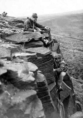 Schoolboy 'tigers' Nev Dyson and Phil Gee on a diet of gritsone. |
If you fancy a gentle stroll along the river bank and through the woods
or a more strenuous hike over the Peak
the Parish of Hayfield offers it all.
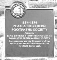
Mass Trespass
70th75th Anniversary
| Valley Strolls | Moorland & Woodland Walks | Ridge Rambles |
|---|---|---|
| Little Hayfield | Kinder Woods |
|
| Sett Valley | William Clough |
|
|
|
Mt Famine |
|
|
|
Snake Path |
|
|
|
|
|
|
|
Schoolboy 'tigers' Nev Dyson and Phil Gee on a diet of gritsone. |
There are ancient well trodden paths and Pack horse trails connecting the Salt Mines of the Cheshire planes in the west and the towns to the east, salt, wool and later cotton and flax as well as manufactured goods from the new industrial towns of Manchester and Sheffield were transported by Pack Mules over the 'Peak'
Then in the 18th ctry roads and eventually railways were constructed skirting the Kinder Massif, the Wood Head line to the north and the Hope Valley line to the south. The 'old road' runs north-south crossing the river Sett at the site of the village of Hayfield connecting the Roman settlements at Glossop to Buxton, the turnpike road followed this route and eventually with some slight deviation the A624 (which runs parallel to the 'old road')
(c) hayfield.info Please respect the generosity and rights of the people who have contributed to this site which is for private and educational use only all rights reserved, no material is to be copied or used for any purposes without first obtaining their permission via info@hayfield.info